| Virtual
Walks-1 From Anglesey Basin at Chasewater to Ogley
Junction (or Anglesey Junction) Anglesey Branch Canal - 1850 |
|||
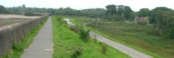
| Visit the Lichfield & Hatherton Canals Restoration Trust web site to find out about the Trust that was formed in 1988 and is a registered charity. It campaigns for the restoration of the "Lichfield Canal" (as the closed section of the W&E between Ogley and Huddlesford is now called) and also the Hatherton Canal through the Cannock / A5 area. It promotes the restoration as public amenities for boating, angling, walking, cycling etc. and raises funds to carry out physical restoration work. | |||
| The Cannock Chase
Reservoir (later known as Norton Pool and now
called Chasewater) was opened in
1799 and feeds water to the whole of the current Wyrley
and Essington Canal, and beyond. Main access to Chasewater from Pool Road (off A5 Watling Street). |
|||
| ------ (More Photos in my Flickr album - Anglesey Branch Canal ) ------ | |||
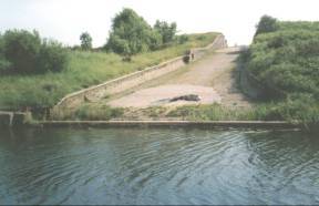
A020 - the dam of
Chasewater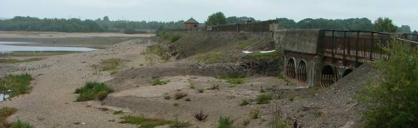 Looking along the dam on the reservoir side while it was drained for major repair work. This photo taken looking north - 3/9/2011. |
 Looking along the dam on the
canal side while the Reservoir was drained for major
repair work. Looking along the dam on the
canal side while the Reservoir was drained for major
repair work.This photo taken looking north - 3/9/2011. |
||
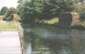
A020 - the overflow
through the dam from Chasewater Reservoir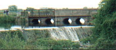 The old structure - before the rebuilding of 2009/2012. Chasewater reservoir full and overflowing through the dam culverts (in the background) into the “nine-foot pool” and then over the lip into the main overflow pound Photo taken looking Southwest. Access to the south end of
the dam via Pool Road (off A5 Watling Street). |
 The new structure - after the rebuilding of 2009/2012. This photo taken looking south-west - 31/3/2016. |
||
 A040 - the
main overflow pound from Chasewater Reservoir A040 - the
main overflow pound from Chasewater ReservoirIn the background - Chasewater reservoir is full and overflowing through the dam culverts into the “nine-foot pool” and then over the lip into the main overflow pound. In the foreground at the far end of the main overflow pound water is running to the right below the lowest point of the fence and plummeting into the modern storm drain system. In the past overflowing water would run via the original spillway that would have run down to the canal below – but only if the overflow pound was full to the brim. (see A060 below.......) The current system takes the overflow under the canal and eventually outflows into the Crane Brook. This photo taken looking west - 31/3/2016. |
|||
 Looking
back to the dam of Chasewater or
Norton Pool as it was previously known. Looking
back to the dam of Chasewater or
Norton Pool as it was previously known. Taken looking back West. Access from Pool Road (off A5 Watling Street). |
|||
 Taken
looking SouthEast. Taken
looking SouthEast.Access from Pool Road (off
A5 Watling Street). |
|||
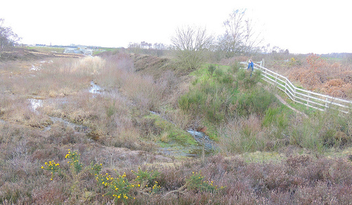
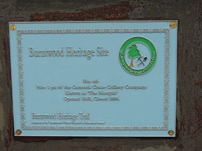 A050 -
Site of :- No:-1 Pit of the Cannock Chase Colliery
Company. Known as 'The Marquis'. Opened 1849. Closed 1856. A050 -
Site of :- No:-1 Pit of the Cannock Chase Colliery
Company. Known as 'The Marquis'. Opened 1849. Closed 1856.Anglesey Basin at the foot of Chasewater Dam OpenStreetMap location
|
|||
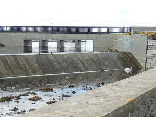
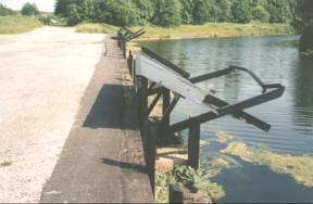
 A060 - Overflow from Chasewater into
canal. A060 - Overflow from Chasewater into
canal.Taken looking South. Access along canal. |
|||
 Bases
of the two overhead coal-loading gantries. Bases
of the two overhead coal-loading gantries.
Taken from opposite overflow looking East. Access along canal. |
|||
 A090 - coal loading shutes from the path
of the now removed colliery railway. A090 - coal loading shutes from the path
of the now removed colliery railway.Taken looking South toward Wharf Lane. Access from Wharf Lane may no longer be possible. |
|||
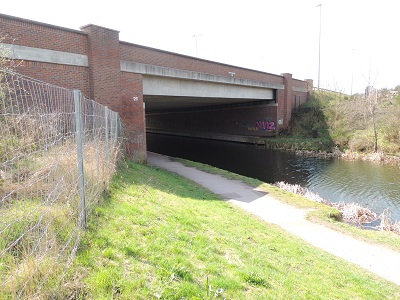 A100 -
Anglesey Wharf Bridge 2003 A100 -
Anglesey Wharf Bridge 2003Carries the M6toll motorway over the canal or the BNRR (Birmingham North Relief Road) as it was first named. The BNRR has caused the closure of the road link
between Brownhills (Whitehorse Road) and Burntwood (Wharf
Lane). The canal and towpath remain.
|
|||
 A110 - Burntwood
Road Bridge (under Whitehorse Road) - A110 - Burntwood
Road Bridge (under Whitehorse Road) - The M6toll (BNRR) has caused the closure of the road link between Brownhills (Whitehorse Road) and Burntwood (Wharf Lane). The canal and towpath will remain. Taken looking South. NO access from Wharf Lane. Foot access to Whitehorse Road from the towpath after passing under the bridge. |
|||
 A110 - Burntwood Road Bridge (under Whitehorse
Road) A110 - Burntwood Road Bridge (under Whitehorse
Road) Taken looking back North. NO access from Wharf Lane. Foot access to Whitehorse Road via the top right of this picture. |
|||
 A130
- Freeth Bridge (under Watling Street) - This is
the modern addition to carry the widened road of the
early 1970s. A130
- Freeth Bridge (under Watling Street) - This is
the modern addition to carry the widened road of the
early 1970s.Taken looking South. Access from The Watling Street (A5) |
|||
 A130 -
Freeth Bridge 1849 (under Watling Street) - The
original part of the bridge. Named after the canal
engineer, Mr. John Freeth (Clerk to the Birmingham Canal
Navigation Co.), who was responsible for the building of
the bridge when the Angelsey Branch was cut. A130 -
Freeth Bridge 1849 (under Watling Street) - The
original part of the bridge. Named after the canal
engineer, Mr. John Freeth (Clerk to the Birmingham Canal
Navigation Co.), who was responsible for the building of
the bridge when the Angelsey Branch was cut.Taken looking back North. https://www.openstreetmap.org/?mlat=52.65623&mlon=-1.92627#map=18/52.65623/-1.92627 Access from Watling Street (A5) |
|||
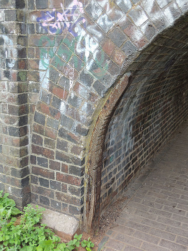
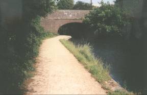
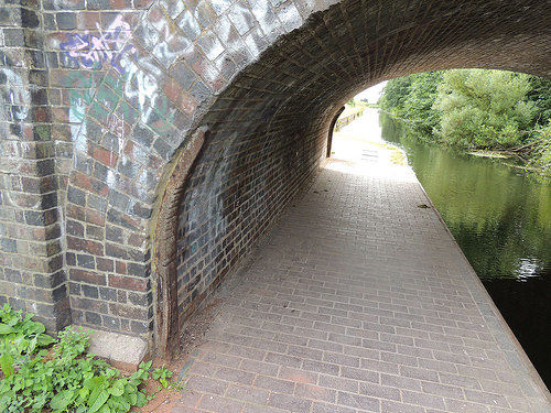
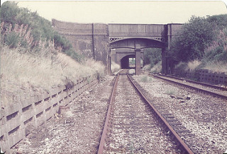  A140 - Aquaduct
over railway. A140 - Aquaduct
over railway. Middleton Railway Aqueduct crossing the L&NWR South Staffordshire Line (now closed). Now much changed by 'The McClean Way' A Greenway from Ryecroft To Brownhills/A5 Back The Track Left - Looking north-east with the A5 Watling
Street bridge in the distance. Access along canal (via Chase Road or The Watling Street) -- and via steps from the railway line.
Photo on the left taken August 1984 |
|||
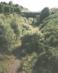
  A140 - Aquaduct
over railway. A140 - Aquaduct
over railway. Middleton Railway Aqueduct crossing the L&NWR South Staffordshire Line (now closed). Now much changed by 'The McClean Way' A Greenway from Ryecroft To Brownhills/A5 Back The Track Left - Taken looking back West toward aquaduct
from under Middleton Bridge. Access along canal (via Chase Road or The Watling Street) -- and via steps from the railway line.
|
|||
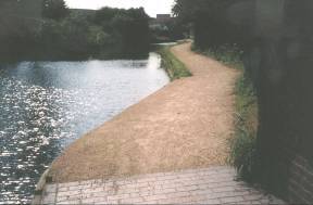
 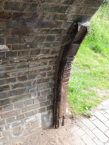 A150 -
Middleton Bridge (under Chase Road) - The bridge
was named after William Middleton, a landowner and farmer
of the area. A150 -
Middleton Bridge (under Chase Road) - The bridge
was named after William Middleton, a landowner and farmer
of the area.Access from Chase Road. Horse power on the canals. One of the few signs of the importance of horses in the past is the marks on some bridges over canals. The tow ropes passing rubbing against corners thousands upon thousands of times cut into the edges. Here are the height (in inches) of the marks above tow path level. Some heights more used than others cut deeper. Add 10 inches for the height of the tow path above water level. West end 24 deep cut/26/30/32/33/34 deep cut/35/37 deep cut/38 deep cut/40 deep cut/41 deep cut/43/45 East end 21/23/26/28 deep cut/30 deep cut/33 deep cut/34 deep cut/35 deep cut/36 deep cut/37 deep cut/38 very deep cut/39/41 very deep cut As the bridge abutment curves in has this kept the cuts from going higher? I will have to measure a straight sided bridge to have an opinion on that …….. These photos taken 25/7/2016 - west end on the
left & east end on the right. |
|||
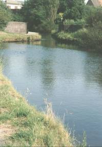
  Middleton Bridge
(under Chase Road). Middleton Bridge
(under Chase Road).Taken looking East. https://www.openstreetmap.org/?mlat=52.65528&mlon=-1.92256#map=18/52.65528/-1.92257 Access from Chase Road at the other side of the bridge. Photo on the right taken 25/7/2016 ------ (More Photos in my Flickr album - Anglesey Branch Canal ) |
|||
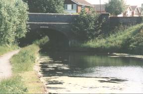
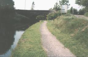
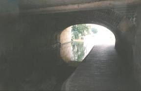
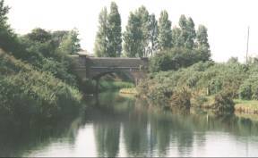 A170 - Anglesey Bridge (signed 1850) - (under
Lichfield Road). A170 - Anglesey Bridge (signed 1850) - (under
Lichfield Road).The poplar trees beyond the bridge mark the site of "The Chemical", a landmark up to the demolition of its tall brick chimney in 1987. Brownhills Chemical Works was opened in 1870, taking advantage of the canal to bring materials from the gasworks at the other side of Brownhills. From the Second World War aluminium alloys were smelted at the site. As "Super Alloys" scrap Gloster Meteor and Javelin aircraft where stacked at the works, awaiting recycling. Taken looking back North from Ogley
Junction (or Anglesey Junction). Access from Lichfield Road. |
|||
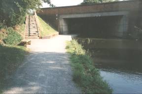
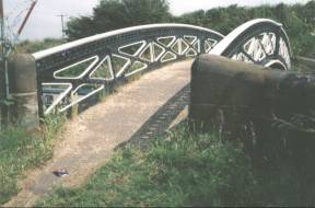 A180 -
Ogley Junction Footbridge A180 -
Ogley Junction Footbridge The bridge is marked "HORSELEY IRON WORKS 1829". Location ---- https://www.openstreetmap.org/?mlat=52.65162&mlon=-1.91607#map=18/52.65162/-1.91607 Access via Lichfield Road, Brownhills. |
|||
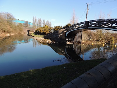 A190 - Ogley Junction A190 - Ogley Junction To the East, the first of 30 locks that drop to Huddlesford Junction along the "Lichfield Canal" being restored by Lichfield & Hatherton Canals Restoration Trust. To the west 16 miles 3 furlongs to Horseley Fields Junction, Wolverhampton. To the north to Chasewater. Access via Lichfield Road, Brownhills. Taken looking north |
|||