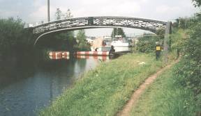
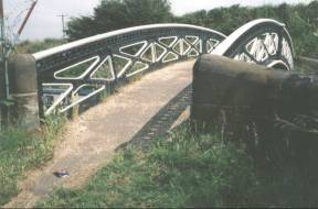
 W010 - Ogley Junction (or Anglesey Junction)
Foot Bridge (2000 & 1982)
W010 - Ogley Junction (or Anglesey Junction)
Foot Bridge (2000 & 1982)The bridge is marked "HORSELEY IRON WORKS 1829".
16
miles and 3¼ furlongs from Horseley Fields Junction.
Location - https://www.openstreetmap.org/?mlat=52.65162&mlon=-1.91607#map=18/52.65162/-1.91607
Taken looking East.
Access via Lichfield Road.
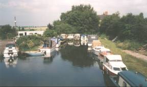
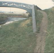
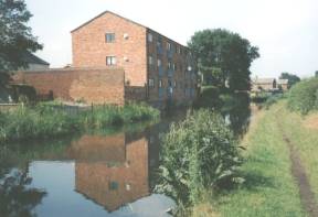
 W020 - Ogley
Junction and Marina at the head of the (currently
disused) locks down toward Huddlesford Junction. Lock
Cottage, 271-272 Lichfield Road is visible between the
trees.
W020 - Ogley
Junction and Marina at the head of the (currently
disused) locks down toward Huddlesford Junction. Lock
Cottage, 271-272 Lichfield Road is visible between the
trees.16 miles and 3¼ furlongs from Horseley Fields
Junction.
Location - https://www.openstreetmap.org/?mlat=52.65156&mlon=-1.91629#map=18/52.65156/-1.91628
Taken looking East from Ogley Junction (or Anglesey Junction) Footbridge - which is pictured right.
Access via Lichfield Road.
 W040
- The Mill (Mill Road)
W040
- The Mill (Mill Road)The "Ogley Hay Steam Flour Mill" - opened in 1841? - Was at one time operated by Haddon and Grimes.
Closed in 1942 and used later for a shoe company and then metal pressing. - Converted to flats as Sadlers Mill in 1999.
Location - https://www.openstreetmap.org/?mlat=52.64649&mlon=-1.92080#map=18/52.64649/-1.92080
Taken looking back North - 750yards before the Anchor Bridge. - Access along canal.
 W060 -
At the rear of Millfield School, 400yards East of
The Anchor Bridge (looking North from towpath)
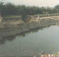
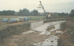
W060 -
At the rear of Millfield School, 400yards East of
The Anchor Bridge (looking North from towpath) 1983 Showing a hole in the bank caused by coal mine collapse.
Location - https://www.openstreetmap.org/?mlat=52.64269&mlon=-1.92141#map=18/52.64269/-1.92140
Access along canal.
------ (More Photos in my Flickr album - Wyrley and Essington Canal )
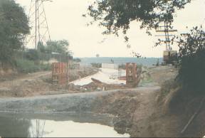
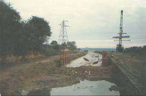
 W060 - August
1983 Rebuild due to mining collapse
W060 - August
1983 Rebuild due to mining collapse(left) Showing coffer dam used while rebuilding took place.
Access via towpath.
By Millfield School, 400yards East of The Anchor
Bridge (looking East from towpath)
Location - https://www.openstreetmap.org/?mlat=52.64269&mlon=-1.92141#map=18/52.64269/-1.92140
------ (More Photos in my Flickr album - Wyrley and Essington Canal )
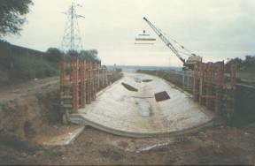
 W060 -
 August 1983 Rebuild due to mining collapsetowpath
(right) By Millfield School, 600yards East of The Anchor Bridge (looking West) towards Chester Road.
Location - https://www.openstreetmap.org/?mlat=52.64269&mlon=-1.92141#map=18/52.64269/-1.92140
------ (More Photos in my Flickr album - Wyrley and Essington Canal )
 W070 - Anchor
Bridge (Under Chester Road (A452).) - On the right
"The Anchor Inn" (Banks's)
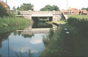
W070 - Anchor
Bridge (Under Chester Road (A452).) - On the right
"The Anchor Inn" (Banks's)15 miles and 4¾
furlongsfrom Horseley Fields Junction.
Location - https://www.openstreetmap.org/?mlat=52.64119&mlon=-1.92411#map=18/52.64118/-1.92411
Taken looking back to the East
Access via Lindon Road and Chester Road/High Street.
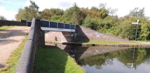 W090 - Catshill Junction Bridge
15
miles and 4¾ furlongs from Horseley Fields Junction.
Location - https://www.openstreetmap.org/?mlat=52.64111&mlon=-1.92784#map=18/52.64111/-1.92784
Taken looking West - 27/09/2012.
Access via towpath and Chandlers Keep via gate.
.