Wyrley and Essington Canal
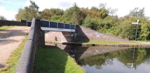
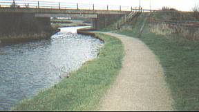
 W090 - Catshill Junction Bridge. The
footbridge crosses the start of the Rushall Canal and
leads towards Wolverhampton 18½ miles away.
W090 - Catshill Junction Bridge. The
footbridge crosses the start of the Rushall Canal and
leads towards Wolverhampton 18½ miles away.The foot
bridge signed BCN 1892.
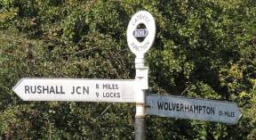
Fingerpost - "(BCNS/BWB 1985) Wton 15½ miles -
Rushall Jcn 8miles 9 locks - Anglesey Basin (Terminus) 2½
miles". (The Anglesey finger was missing by 2012)
15 miles and 3¼ furlongs from Horseley Fields
Junction
Location - https://www.openstreetmap.org/?mlat=52.64097&mlon=-1.92796#map=18/52.64097/-1.92796
Access via towpath
Taken looking West - 27/09/2012.
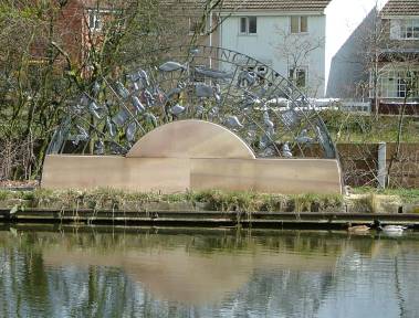
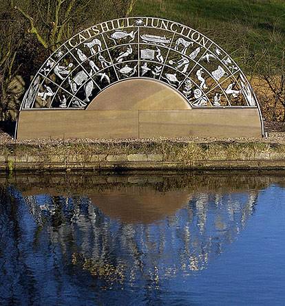 W090 - "Cycle of Life" at Catshill
Junction
W090 - "Cycle of Life" at Catshill
JunctionA sculpture from local artists Ron Thompson and Julie Edwards of Planet Art.
British Waterways commissioned the piece of community artwork as part of an improvement of the canal network funded by £2 million from British Waterways and the European Regional Development Fund. Walsall Council Mayor, John Cook, and Mayoress, Lynn Staffiere, unveiled the work on 12 December 2005.
Photo left - taken looking NorthEast - 10/04/2006.
Photo right - copyright Planet Art.
Location - https://www.openstreetmap.org/?mlat=52.64116&mlon=-1.92766#map=18/52.64116/-1.92766
Access via towpath opposite the sculpture.
 W100
- "The Spot" footbridge or "Market Bridge"
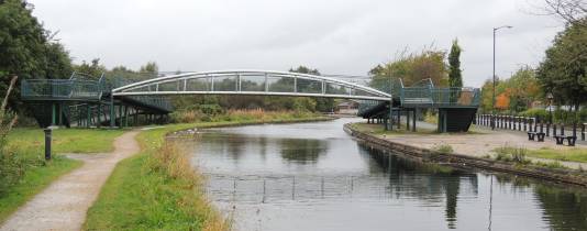
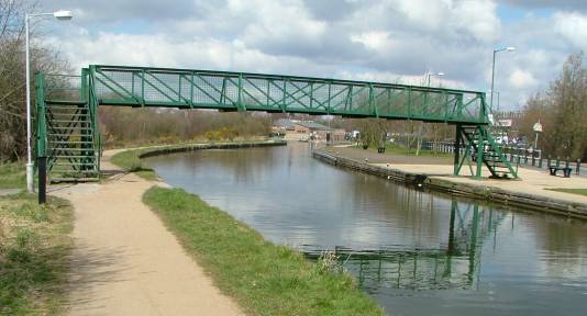
W100
- "The Spot" footbridge or "Market Bridge"Access from Silver Street, Pier Street(pedestrianised) and Spot Lane(footpath).
Taken looking NorthWest - main towpath on the left - short Silver Street towpath on the right.
15 miles and ¾ furlongs from Horseley Fields Junction
Location - https://www.openstreetmap.org/?mlat=52.64451&mlon=-1.93323#map=18/52.64451/-1.93323
The photo on the right taken 10/04/2006.
The photo on the left taken 02/10/2012.
Connects Clayhanger at Spot Lane (previously Little
Wyrley Road) with Brownhills.
The new bridge was officially opened on Friday 5th.
October 2007.
The previous metal structure replaced an earlier wooden
footbridge. On the right, at the end of Pier Street, was
a canal-side pub (The Pier Inn and previously "The
Fortune of War"). It was used by working boaters up
to the end of the 1950s. Pier Street was named after the
pier built into the canal for loading and unloading.
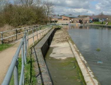
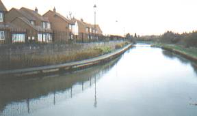
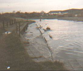 An
overflow in winter and summer December 1984 (left) and
April 2006 (right).
An
overflow in winter and summer December 1984 (left) and
April 2006 (right).Taken looking North.
(just North of "The Spot" footbridge)
Location - https://www.openstreetmap.org/?mlat=52.64546&mlon=-1.93436#map=18/52.64545/-1.93436
Access via towpath
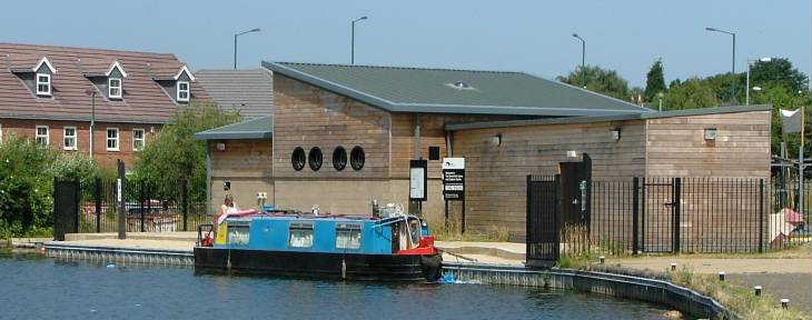 W110 - Brownhills Canoe Club
(or "Brownhills Canoe and Outdoor Centre")
(or Royal Sutton Coldfield Canoe Club)
The Club state ...
"We officially opened our doors in June 2006
during the Brownhills Canal Festival
The Centre was built with funding from Active England (a
joint funding programme between Sport England and the Big
Lottery Fund), the European Regional Development Fund and
British Waterways.
Our aim is..'to provide a venue for the community of
Brownhills and the surrounding areas to take part in the
sport of canoeing and other outdoor recreational pursuits'
" (From their old web site)
Location - https://www.openstreetmap.org/?mlat=52.64612&mlon=-1.93491#map=18/52.64612/-1.93491
Taken looking North - 16/07/2006.
main towpath on the left - short Silver Street towpath on
the right (Access via "The
Spot" footbridge or direct from
Silver Street)
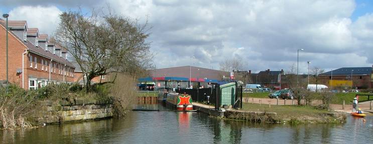
W120 - Brownhills Basin & wharfs ---- LMS Railway Interchange Basins
On the left before housing development and the Brownhills Canoe and Outdoor Centre
arrived.
Taken looking North - 2001.
On the right with housing development and
the Brownhills Canoe and Outdoor Centre.
Taken looking North - 10/04/2006.
14 mile and 7½ furlongs from
Horseley Fields Junction
Location - https://www.openstreetmap.org/?mlat=52.64613&mlon=-1.93529#map=18/52.64613/-1.93529
Viewed from towpath (Access via "The Spot" footbridge from Silver Street)
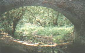
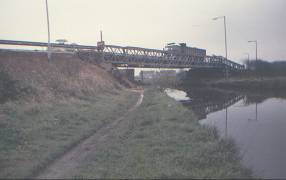
 W130 -
The Midland Railway bridge route
from Birmingham to Wolverhampton via Walsall was opened
in 1879. To provide access to the coalfields in the
Chasewater area a branch line of about five miles was
planned from the "Sutton Park Line" at Aldridge
and the branch line serving Brownhills coal mines opened
to goods in November 1882.In 1962 goods services finally
withdrawn with the closure of local pits and the line
closed.
W130 -
The Midland Railway bridge route
from Birmingham to Wolverhampton via Walsall was opened
in 1879. To provide access to the coalfields in the
Chasewater area a branch line of about five miles was
planned from the "Sutton Park Line" at Aldridge
and the branch line serving Brownhills coal mines opened
to goods in November 1882.In 1962 goods services finally
withdrawn with the closure of local pits and the line
closed.General view taken looking East - close-up taken looking North. Access via towpath
14 mile and 6 furlongs from Horseley Fields
Junction
Location - https://www.openstreetmap.org/?mlat=52.64468&mlon=-1.93959#map=18/52.64468/-1.93959
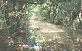
 W140 - Coopers
Bridge carries a farm lane to Swingbridge Farm(disused)
once run by a Mr. Cooper. A earlier swing bridge crossed
the canal at this point, giving the name to the farm.
W140 - Coopers
Bridge carries a farm lane to Swingbridge Farm(disused)
once run by a Mr. Cooper. A earlier swing bridge crossed
the canal at this point, giving the name to the farm.Taken looking West.
Access from towpath or Lapwing Close
14 mile and 5¾ furlongs from Horseley Fields Junction
Location - https://www.openstreetmap.org/?mlat=52.64468&mlon=-1.94023#map=18/52.64468/-1.94023
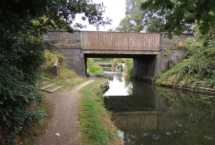
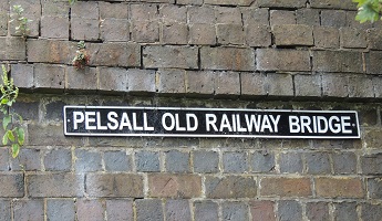 W150
- "Pelsall Old Railway Bridge"
W150
- "Pelsall Old Railway Bridge"Rail bridge - which did carry the South Staffordshire Railway to Brownhills.
The track bed is currently a walkway - "The McClean Way"
On the left - taken looking North - 08/08/2018.
On the right - The north-west corner of the Bridge - 08/08/2018.
Access access via steps from "The McClean Way"
14 miles and 4½ furlongs from Horseley Fields
Junction
Location - https://www.openstreetmap.org/?mlat=52.64474&mlon=-1.94367#map=18/52.64474/-1.94367
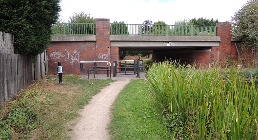
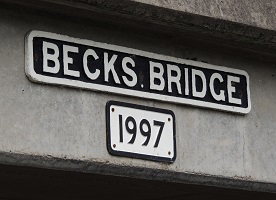 W160
- Becks Bridge (under Pelsall Road (A4124)) -
bridge is dated 1997.
W160
- Becks Bridge (under Pelsall Road (A4124)) -
bridge is dated 1997.On the left - taken looking North - 08/08/2018.
On the right - The southern face of the Bridge - 08/08/2018.
Access via towpath - No Access from Pelsall Road.
14 miles and 4 furlongs from Horseley Fields Junction
Location - https://www.openstreetmap.org/?mlat=52.64537&mlon=-1.94431#map=18/52.64537/-1.94431
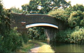
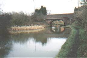
 W170 - Jolly
Collier Bridge - under Coppice Side. The Jolly
Collier public house was at the nearby corner of Coppice
Side and Pelsall Road.
W170 - Jolly
Collier Bridge - under Coppice Side. The Jolly
Collier public house was at the nearby corner of Coppice
Side and Pelsall Road.Taken looking West.
Access via steps to Coppice Side
14 miles and 2¼ furlongs from Horseley Fields
Junction
Location - https://www.openstreetmap.org/?mlat=52.64424&mlon=-1.94884#map=18/52.64424/-1.94884
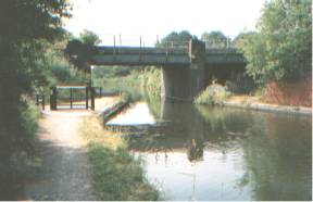
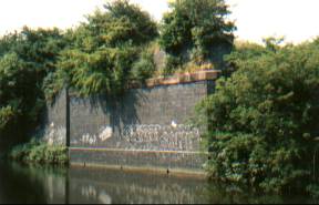
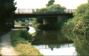
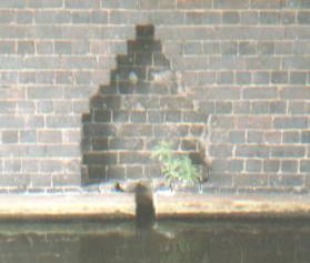 W180 - Old South
Staffordshire Railway bridge now Beacon Way long
distance walk over canal. The view on the right shows an
alcove in brickwork of bridge to allow for planks to
block canal for drainage, etc.
W180 - Old South
Staffordshire Railway bridge now Beacon Way long
distance walk over canal. The view on the right shows an
alcove in brickwork of bridge to allow for planks to
block canal for drainage, etc.Taken looking West.
Access via towpath or steps from Beacon Way
14 miles and 1 furlongs from Horseley Fields Junction
Location - https://www.openstreetmap.org/?mlat=52.64495&mlon=-1.95256#map=18/52.64495/-1.95256
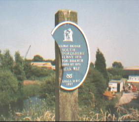 The
Beacon Way - The sign dated 1997 reads "South
Staffordshire Railway 1858, Norton Branch, Closed 1975".
The
Beacon Way - The sign dated 1997 reads "South
Staffordshire Railway 1858, Norton Branch, Closed 1975".
Taken from Beacon Way on bridge - looking East
Access along canal via steps or from Beacon Way.
14 miles and 1 furlongs from Horseley Fields Junction
Location - https://www.openstreetmap.org/?mlat=52.64495&mlon=-1.95256#map=18/52.64495/-1.95256
 W210 - Engine Lane Bridge
Those who follow the Beacon Way north along the line of the railway will come to Engine Lane (footpath) to the left and Coppice Lane to the right. The bridge crosses the remains of the canal arm that connected the Wyrley and Essington Canal to the coal mines of Brownhills West.
Location - https://www.openstreetmap.org/?mlat=52.64919&mlon=-1.95277#map=18/52.64920/-1.95276
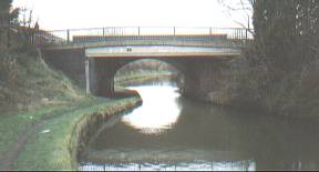
 W220 - High
Bridge Bridge Under Pelsall Road/Lichfield Road (A4124).
Also known as "the high bridges" as the locals
used to call them when the Pelsall Road crossed both the
canal and the adjacent railway
W220 - High
Bridge Bridge Under Pelsall Road/Lichfield Road (A4124).
Also known as "the high bridges" as the locals
used to call them when the Pelsall Road crossed both the
canal and the adjacent railwayTaken looking Northeast, back towards Brownhills.
Access from Lichfield Road (A4124) via steps
13 miles and 5½ furlongs from Horseley Fields
Junction
Location - https://www.openstreetmap.org/?mlat=52.64043&mlon=-1.95775#map=18/52.64043/-1.95775
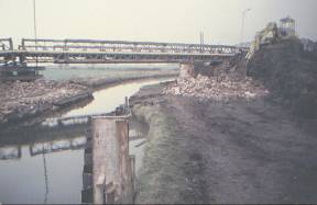 "the high bridges" in December
1984 when the previous twin bridges were replaced. At the
time some of the older locals were worried that pile-driving
for the foundations would find a reputed unexploded bomb
from the Second World War - if the bomb was down there,
it is still down there, still unexploded!
"the high bridges" in December
1984 when the previous twin bridges were replaced. At the
time some of the older locals were worried that pile-driving
for the foundations would find a reputed unexploded bomb
from the Second World War - if the bomb was down there,
it is still down there, still unexploded!On the left taken looking Northeast back towards Brownhills. On the right taken looking Southwest towards Pelsall.
13 miles and 5½ furlongs from Horseley Fields
Junction
Location - https://www.openstreetmap.org/?mlat=52.64043&mlon=-1.95775#map=18/52.64043/-1.95775
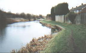
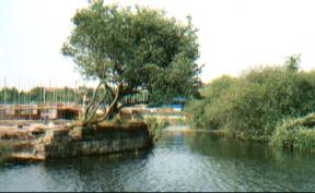
 W230 - Gilpins Arm - the photo on the
right is the site of the start of the arm. Until a recent
house build, the other end of the arm could still seen as
a wide ditch at the side of Norton Road, opposite Green
Lane, Pelsall.
W230 - Gilpins Arm - the photo on the
right is the site of the start of the arm. Until a recent
house build, the other end of the arm could still seen as
a wide ditch at the side of Norton Road, opposite Green
Lane, Pelsall.Taken looking Northeast, back towards Brownhills.
Access via towpath.
Location - https://www.openstreetmap.org/?mlat=52.63658&mlon=-1.96249#map=18/52.63658/-1.96249
 W240 - Yorks Foundry Bridge - Under
Lichfield Road (A4124). The current bridge is a modern
widening of the original.
W240 - Yorks Foundry Bridge - Under
Lichfield Road (A4124). The current bridge is a modern
widening of the original.On the left taken looking North. On the right taken looking South back towards Brownhills.
Access from Lichfield Road.
13 miles and 2½ furlongs from Horseley Fields
Junction
Location - https://www.openstreetmap.org/?mlat=52.63684&mlon=-1.96410#map=18/52.63684/-1.96410
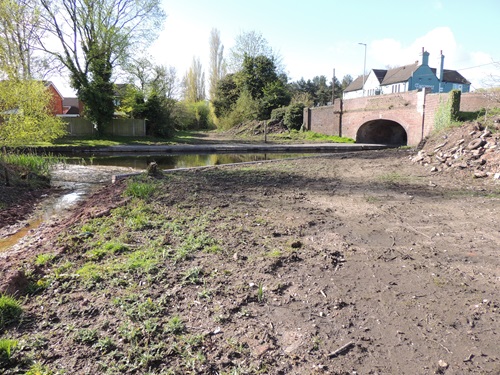 W245 - a new York's Bridge - Under Norton
Road (B4154).
W245 - a new York's Bridge - Under Norton
Road (B4154). Taken looking south - 14/4/2024.
Access from Norton Road (B4154) - around the back of the pub.
York’s Bridge replacement scheme. Walsall Council is seeking to replace the existing York’s Bridge on Norton Road in Pelsall (while leaving the original bridge intact.)
Groundwork in preperation for the new bridge.
13 miles and 1 furlongs from Horseley Fields Junction.looking
north at
www.openstreetmap.org/?mlat=52.63832&mlon=-1.96818#ma...
what3words.com/kinds.pads.vest
use map type OSM
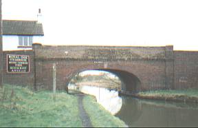
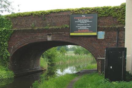
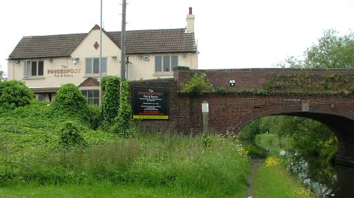 W250 -
York's Bridge - Under Norton Road (B4154).
W250 -
York's Bridge - Under Norton Road (B4154). Taken looking West - 2/6/2007.
Access from Norton Road (B4154) - around the back of the pub.
The photo on the left with "The Fingerpost Pub" to the left.
The photo on the right from 2001 as the Royal Oak pub (Ansells) to the left.
13 miles and 1 furlongs from Horseley Fields Junction
Location - https://www.openstreetmap.org/?mlat=52.63832&mlon=-1.96818#map=18/52.63832/-1.96818
 York's Bridge - Taken looking East - 2/6/2007.
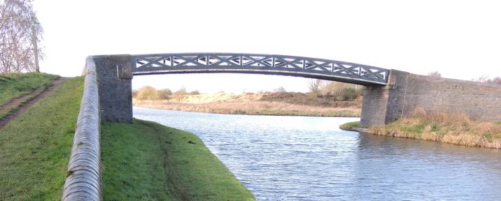 W260 - Pelsall Junction Bridge footbridge
 taken looking West - 17/1/2014.
Access from Pelsall via Nest Common on the left.
Access from the Cannock Extension Canal and
Pelsall North Common
over the footbridge to the right.
12 miles and 7½ furlongs from Horseley Fields
Junction
Location - https://www.openstreetmap.org/?mlat=52.63771&mlon=-1.97225#map=18/52.63771/-1.97225
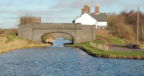 Friar Bridge - at the start of Cannock
Extension branch.
Friar Bridge - at the start of Cannock
Extension branch.Taken looking North from Pelsall Junction - 17/1/2014.
Access from Pelsall North Common.
Access from Pelsall via Nest Common and over the
footbridge out of shot on the right.
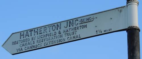
The sign indicates what was the plan for connecting a
restored Hatherton Branch Canal to the W&E via the
Cannock Extension branch. Due to various problems the
LHCRT now plan that a connection to the W&E will be a
little farther along the route to Wolverhampton.
See Virtual Walks-7
Pelsall Junction to Lord Hayes Branch for more details.
Location - https://www.openstreetmap.org/?mlat=52.63838&mlon=-1.97263#map=18/52.63838/-1.97263
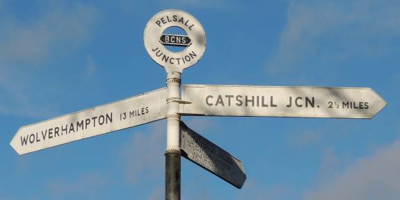 W270 - Pelsall Junction - 12
miles 7¼ furlongs from Horseley Fields Junction,
Wolverhampton.
W270 - Pelsall Junction - 12
miles 7¼ furlongs from Horseley Fields Junction,
Wolverhampton.Taken looking North from Pelsall Junction - 17/1/2014.
Left onward towards Wolverhampton. ( See Virtual Walks-7 )
Straight ahead over the footbridge to the Cannock
Extension branch. ( See Virtual Walks-6
).
Right back to Brownhills.
12 miles and 7¼ furlongs from Horseley Fields
Junction
Location - https://www.openstreetmap.org/?mlat=52.63765&mlon=-1.97264#map=18/52.63765/-1.97263