Wyrley and Essington Canal
and
Onward along the Hatherton Canal (under restoration) to its Junction of the Staffordshire and Worcestershire Canal
The other distances are from Hatherton Junction used for the route when restored and realigned in places by LHCRT.
 Friar
Bridge - at the start of Cannock Extension branch.
Friar
Bridge - at the start of Cannock Extension branch.Taken looking North from Pelsall Junction - 17/1/2014.
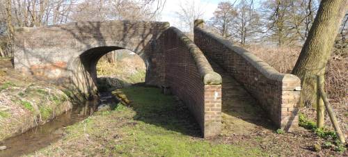
Access from Pelsall North Common.
Access from Pelsall via Nest Common and over the
footbridge out of shot on the right.
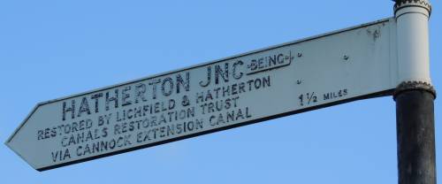
The sign indicates what was the plan for connecting a
restored Hatherton Branch Canal to the W&E.
Due to various problems the LHCRT now plan that a
connection to the W&E will be a little farther along
the route to Wolverhampton.
Location - https://www.openstreetmap.org/?mlat=52.63838&mlon=-1.97263#map=18/52.63838/-1.97263
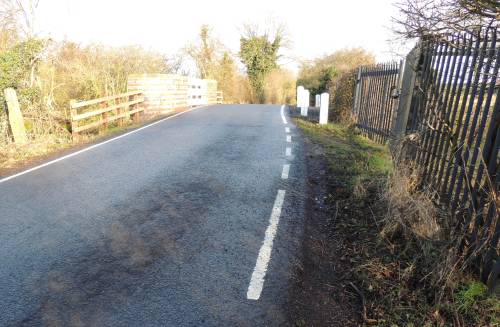
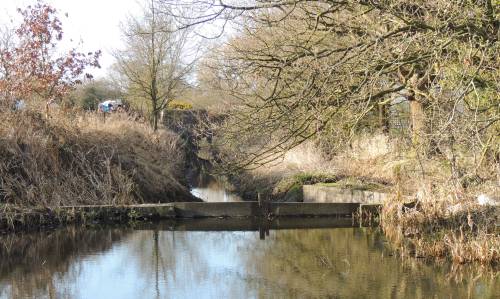
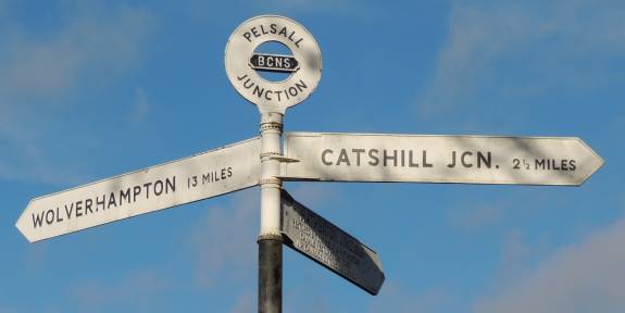 W270 -
Pelsall Junction - 12
miles 7¼ furlongs from Horseley Fields Junction,
Wolverhampton.
W270 -
Pelsall Junction - 12
miles 7¼ furlongs from Horseley Fields Junction,
Wolverhampton.Taken looking North from Pelsall Junction - 17/1/2014.
Access from Pelsall North Common and the Cannock
Extension branch via footbridge.
Access from Pelsall via Nest Common.
Left onward towards Wolverhampton and the Lord Hayes Branch
Straight ahead over the footbridge to the Cannock
Extension branch. ( See Virtual Walks-6 ).
Right to Brownhills and Catshill Junction.
( See Virtual Walks-3 )
12 miles and 7¼ furlongs from Horseley Fields
Junction
Location - https://www.openstreetmap.org/?mlat=52.63765&mlon=-1.97264#map=18/52.63765/-1.97263
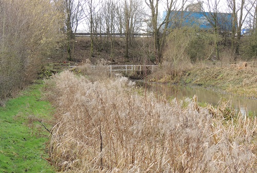
12 miles 4¼ furlongs from Horseley Fields Junction, Wolverhampton.
Location - https://www.openstreetmap.org/?mlat=52.63667&mlon=-1.97988#map=18/52.63668/-1.97988
Taken looking West - 17/1/2014.
Access from Pelsall via Wood Lane and Nest Common (on the
left).
Access from Pelsall North Common (on the right).
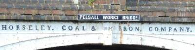
The bridge is dated "1824"
NOTE - the sign on the other side of the bridge reads
-
"PELSALL WORKS"
Taken looking West - 17/1/2014.
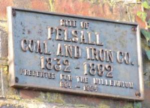
The plaque from the Pelsall Millenium - 1994
Taken looking West - 17/1/2014.
 W290/H020
- Fishley Junction of the Wyrley and Essington Canal with the Lord Hayes (or Hay's) Branch -
W290/H020
- Fishley Junction of the Wyrley and Essington Canal with the Lord Hayes (or Hay's) Branch - 12 miles ¾ furlong from Horseley Fields Junction, Wolverhampton.
also
7 miles from Hatherton Junction
Location - https://www.openstreetmap.org/?mlat=52.63619&mlon=-1.98886#map=18/52.63619/-1.98886
The turn into the (currently infilled) Lord Hayes Branch is on the right of the photo.
Taken looking SouthWest - 17/1/2014.
The plan for connecting a restored Hatherton Branch
Canal to the W&E was to be via the Cannock Extension
branch. ( See Virtual Walks-6 ).
Due to various problems the LHCRT now plan that a
connection to the W&E will be here via the Lord Hayes Branch.
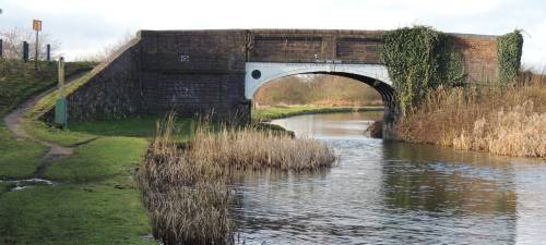
 W300/H010
- Fishley Junction Bridge (Fishley
Roving Bridge)-
W300/H010
- Fishley Junction Bridge (Fishley
Roving Bridge)- 12 miles ½ furlong from Horseley Fields Junction, Wolverhampton.
Location - https://www.openstreetmap.org/?mlat=52.63580&mlon=-1.98887#map=18/52.63580/-1.98887
Taken looking SouthWest - 17/1/2014.
Access to the (currently infilled) Lord Hayes Branch (to the right of the photo) via the footbridge.
 W290/H020Fishley
Junction to the closed Lord Hayes (or
Hay's) Branch Canal -
W290/H020Fishley
Junction to the closed Lord Hayes (or
Hay's) Branch Canal -12 miles ¾ furlong from Horseley Fields Junction, Wolverhampton.
also
7 miles from Hatherton Junction
https://www.openstreetmap.org/?mlat=52.63619&mlon=-1.98886#map=18/52.63619/-1.98886
Taken looking NorthWest - 17/1/2014.
Access to the (currently infilled) Lord Hayes Branch via the footbridge (out of shot to the left of the photo).
A footpath follows the line of the canal.
| The Lichfield & Hatherton Canals Restoration Trust campaigns for the restoration of the Hatherton Canal from the Wyrley and Essington, through the Cannock / A5 area to meet the Staffordshire and Worcestershire Canal at Hatherton Junction, Calf Heath. It promotes the restoration as public amenities for boating, angling, walking, cycling etc. and raises funds to carry out physical restoration work. |
Most importantly, note that breaking a leg in the middle of nowhere is hazardous to health.
 Fishley No.
1 Bridge - ¾ furlong
from Fishley Junction
Fishley No.
1 Bridge - ¾ furlong
from Fishley JunctionLocation - https://www.openstreetmap.org/?mlat=52.63655&mlon=-1.99115#map=18/52.63655/-1.99115
Taken looking NorthEast - 17/1/2014.
POOR access via Fishley Lane (do
not fall into the pond!) to the right of the photo.
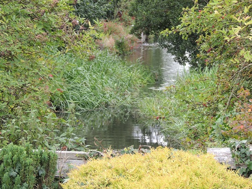
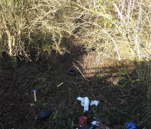 Lords
Hayes Branch/Hatherton Canal Junction - ¾ furlong farther on from Fishley No. 1 Bridge
Lords
Hayes Branch/Hatherton Canal Junction - ¾ furlong farther on from Fishley No. 1 BridgeTaken looking NorthWest from Fishley No. 1 Bridge - 17/1/2014.
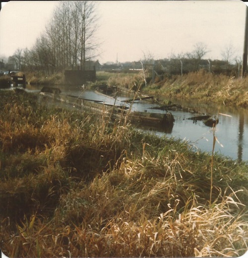
Although overgrown the line of the canal is still traceable.
After another ¾ furlong farther on from Fishley No. 1 Bridge a new section of canal will be cut on the right bank of the Lords Hayes Branch leading eventually to Hatherton Junction at Calf Heath on the Staffordshire and Worcestershire Canal. The outline of the expected work is detailed below ...
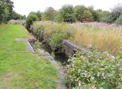
 H310/CB350
Lock 4 - Wedges Mill Lock - 8ft. 6in. (2.6m)
H310/CB350
Lock 4 - Wedges Mill Lock - 8ft. 6in. (2.6m) H320/CB360
Bridge 9 - Wedges Mill Bridge
H320/CB360
Bridge 9 - Wedges Mill Bridge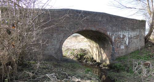
 H340
Meadow Lock (Lock 3)
H340
Meadow Lock (Lock 3)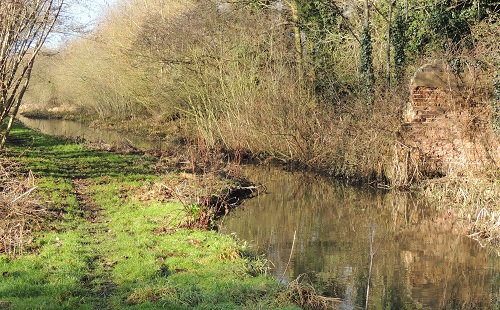 H350
Bridge No 7 (demolished) - Bridge narrows will remain.
H350
Bridge No 7 (demolished) - Bridge narrows will remain.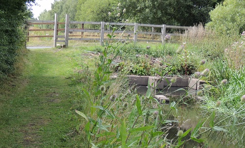 H360
Catch Bridge or Cats Bridge - (Catsbridge Lane)
H360
Catch Bridge or Cats Bridge - (Catsbridge Lane)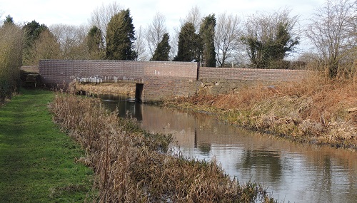 H370
Cross Bridge (Four Crosses Lane)
H370
Cross Bridge (Four Crosses Lane)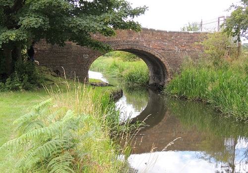 H380
Saredon Mill Bridge
H380
Saredon Mill Bridge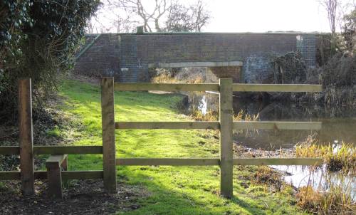
 H400 M6
Tunnel (north-east end)
H400 M6
Tunnel (north-east end)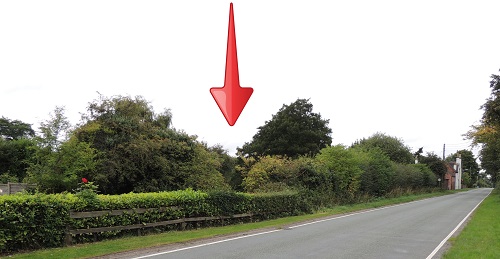
 H430 Dog Bridge (Bridge No. 2)
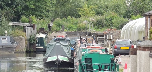
 H440 Calf Heath Locks (lock 2) -
Lock to be used as narrows with no drop
H440 Calf Heath Locks (lock 2) -
Lock to be used as narrows with no drop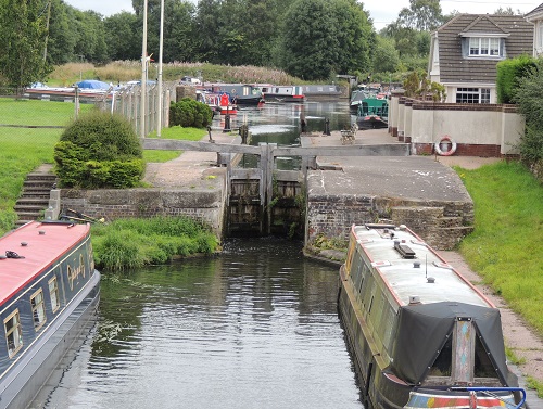 H450
Calf Heath Locks (lock 1)
H450
Calf Heath Locks (lock 1) 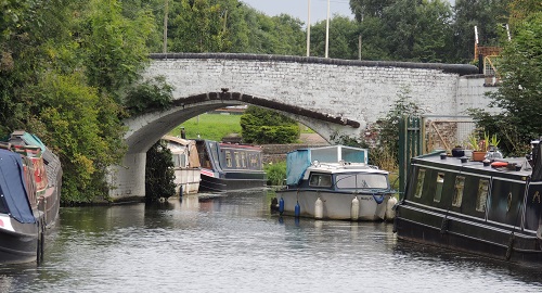 H460
Junction Bridge, Kings Road (Bridge No. 1)
H460
Junction Bridge, Kings Road (Bridge No. 1)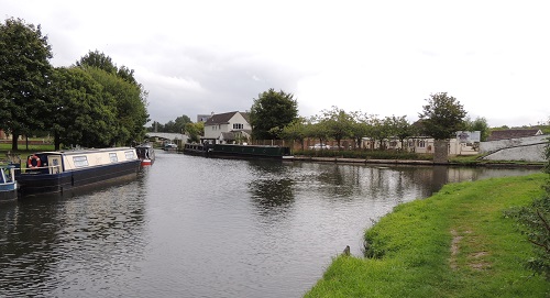
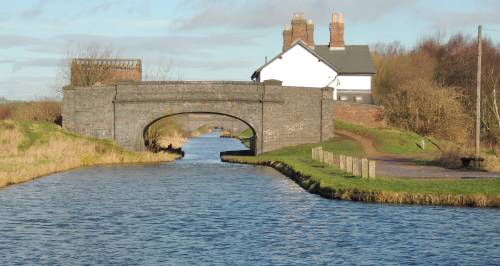
 H470 Hatherton Junction -
Junction of the Staffordshire and Worcestershire Canal
and the Hatherton Canal (under restoration)
H470 Hatherton Junction -
Junction of the Staffordshire and Worcestershire Canal
and the Hatherton Canal (under restoration)